Latitude Longitude Radius Geo Fencing
Release Date: August 26th, 2026
The Geo Fencing tool in the Audiences tab now supports an additional targeting method using Latitude, Longitude, and Radius.
Users can choose between two location options:
- Geofence: Selected by default and allows users to draw and manage a custom map shape.
- Lat/Long: Allows users to define a location using latitude, longitude, and radius instead of drawing a geofence.
When Lat/Long is selected, the map shape controls are replaced with fields for:
- Latitude: 40.7128
- Longitude: -74.0060
- Radius in meters: 250
Latitude and longitude accept decimal values, and the radius is entered in meters.
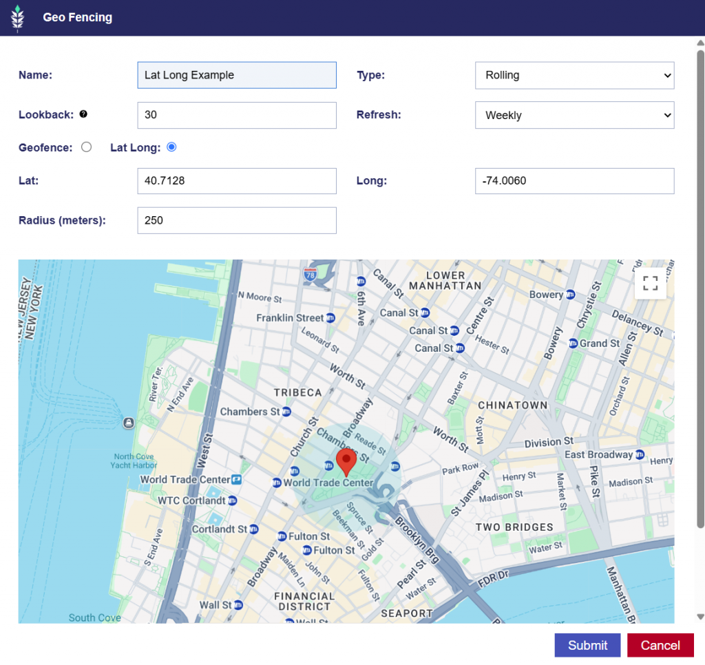
The selected targeting method and location values are saved with the audience and used when the audience is submitted for processing. The Rolling and Static types remain consistent with the Geo Fence targeting method.